Bill Rankin
One World II
Cartographie, 2015
Visit the project
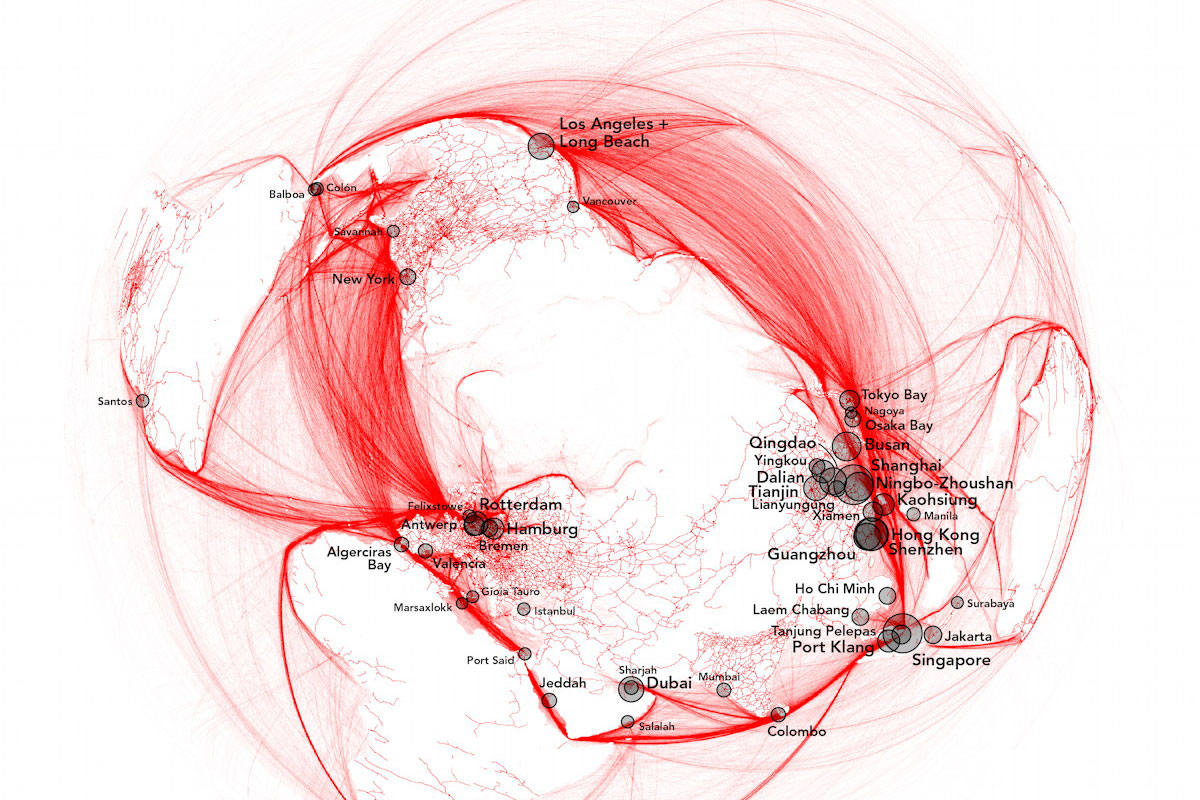
At the height of World War II, the architect-turned-cartographer Richard Edes Harrison published his famous “One World, One War” map in Fortune magazine, which used a polar projection to show the United States in close proximity to the threats from Germany and Japan. Compared to the isolationist message of the Mercator, it made engagement with the war seem like a geographic imperative.
My map updates Harrison’s basic idea for the present day. Instead of showing territorial states engaged in a global war, my version uses shipping routes and railways to show the intermodal donut of global capitalism – the frenetic circulation across the North Atlantic and Pacific Oceans, the thick rope threading through the Suez Canal and the Strait of Malacca, and the offshoots to South America, Australasia, and Africa. By using a different projection with a different orientation, I also decenter the United States and transform a world of seven separate continents into a single borderless network.
Bill Rankin is a historian and cartographer at Yale University. His mapping activity reimagines familiar geographies as complex landscapes of statistics, law, and history; his maps have appeared in publications and exhibitions throughout the US, Europe, and Asia. His recently published book, After the Map, is a history of the mapping sciences in the twentieth century.