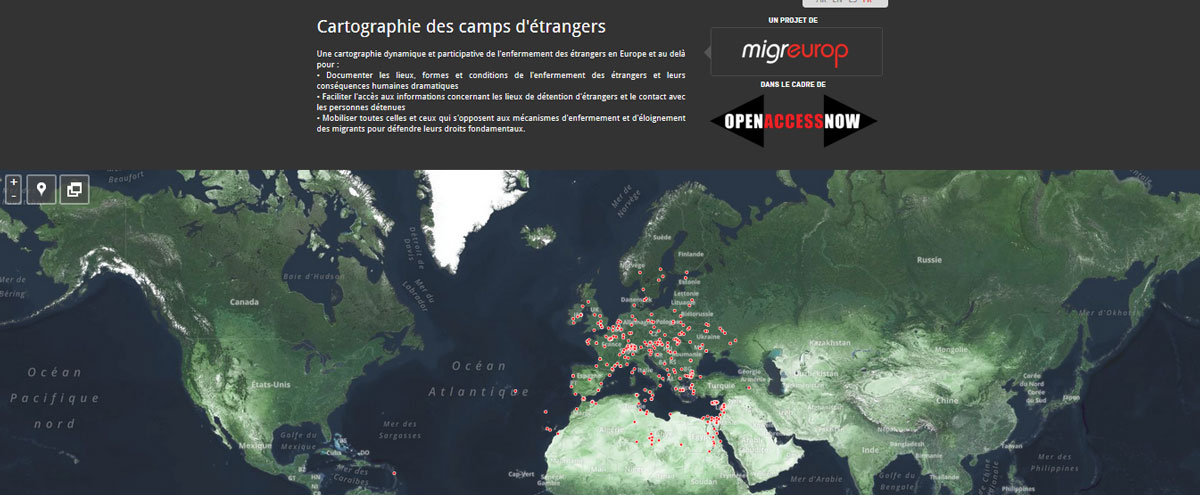
Migreurop – Dynamic Map of Foreign Citizens Detained at State Borders

Migreurop
Dynamic Map of Foreign Citizens Detained at State Borders
Cartography, 2013

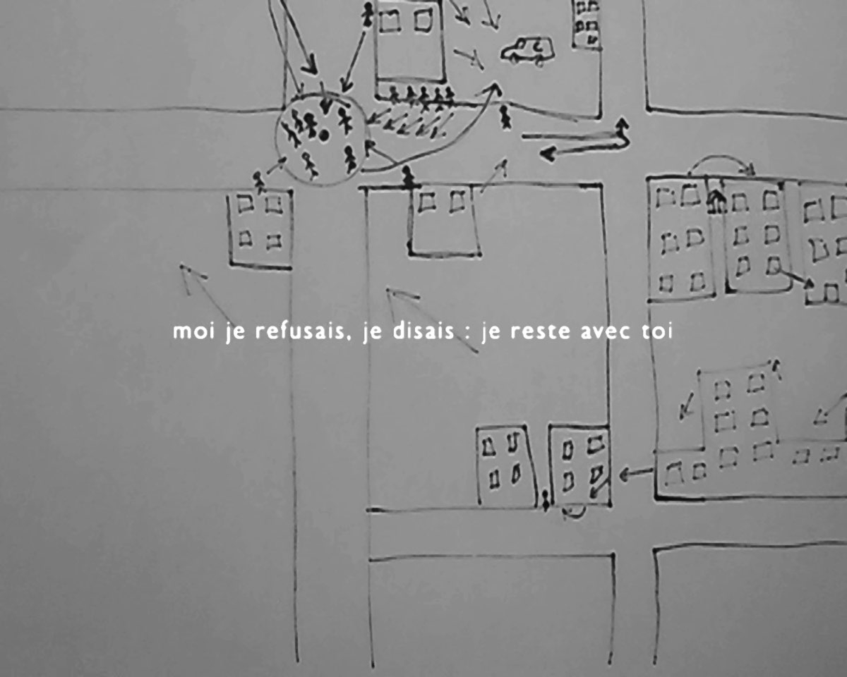
The map of detention facilities in Europe and the Mediterranean countries produced by Migreurop is the basis of the project of establishing a dynamic mapping of the detention of foreigners . The aim is to describe these geographical entities with their corollaries attributes, taking into account the temporal dimension (1980 – 2012) which is an important factor in understanding the evolution of the confinement of migrants which operates within the European Union and beyond its borders into neighbouring countries. As in any geographic information system, the development of a database aims to better identify, describe and locate places of confinement. The idea is to present a dynamic mapping and analysis of contemporary camps at different scales, arriving to the production of a regional or European map through the development of intermediate strata. The project also aims to provide practical tools to both prisoners and families or friends wishing to contact their relatives.

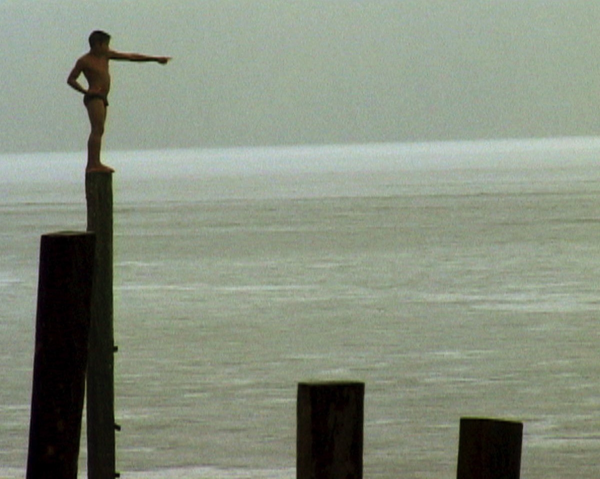
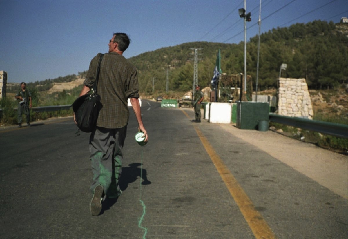
Every day, in the European Union (EU) and the countries with which the EU has close partnerships, children, women and men are arrested and detained in places where the period of administrative detention may last for a few hours to several months or even years. Their “crime”  is that they have no regular residence permits or travel documents. In the last twenty years, authorities in these countries are increasingly defining the mere act of  crossing of borders by foreigners without such documents  and their  status of being “undocumented”  as criminal.

Migreurop opposes these policies of confinement as their consequences.

Thus, on the occasion of the exhibition of the antiAtlas of borders, the network has set up a “closethecamps.org” website that  stores and makes public information related to this type of detention centres  where people are imprisoned, sometimes without trial. Places of detention that appear on the “closethecamps.org ” website  were operational in 2013, or 2011 and/or 2012 (If there has been no information about  possible closure of such centres for the past two years, they are included on the website.).

This project is interactive : as visitors you will be able to discover these places, some of which may be right next to you, and have the possibility of bringing additional information (see the page “Contribute!” on the site). Besides the internet, there is a telephone for those who want to call a centre to hear the testimony of detainees, or try to understand what is happening inside the “border”. By clicking on the “closethecamps.org” website, you will find the French camps listed below, as well as the numbers of phone booths located inside these places :

– Bordeaux
– Coquelles
– Hendaye
– Lille 2
– Lyon
– Marseille (Canet)
– Mesnil Amelot 2 et 3
– Metz Queuleu
– Nice
– Nîmes
– Palaiseau
– Paris Dépôt
– Paris-Vincennes
– Perpignan
– Plaisir
– Rennes
– Rouen
– Sète
– Strasbourg
– Toulouse-Cornebarrieu

You are invited  to phone only to the booths and not to NGOs working within these centers so as not to disturb their work .

Telephone conversations you have with detainees must take place in a respectful environment. Please also be careful not to feed false hopes (particularly in relation to their administrative status) nor to add to the plight of people with whom you come in contact .

La Compagnie” reserves the right to remove the telephone for a temporary period.

This work results from the cooperation between: Lydie Arbogast (Migreurop), Alessandra Capodanno (Migreurop), Olivier Clochard (Migrinter, University de Poitiers / Migreurop), Agathe Etienne(Migreurop), Thomas Honoré (Pôle Carto, Incittà, Marseille), David Lagarde (Lisst, University de Toulouse 2 / Migreurop),Nicolas Lambert (Riate, University Paris 7 Denis Diderot / Migreurop), Nicolas Pernet (Cimade), Laurence Pillant(Telemme, University Aix-Marseille) Louise Tassin (Urmis, University Paris 7 Denis Diderot / Migreurop), Ronan Ysebaert (Riate, University Paris 7 Denis Diderot). These authors have already been working together since 2011, in the context of the Atlas of migrants in Europe, Critical Geography of Migration Policies (published by Armand Colin in November 2012, p. 144) and on the mapping of migrant detention camps.

Lucas Bambozzi – Do Outro Lado Do Rio / Across the River

Lucas Bambozzi
Do Outro Lado Do Rio
Documentary, 2004

Do Outro Lado do Rio is a trip to the limits of Brazil. An investigation of the undefined area between the cities of Oiapoque (Brazil) and Saint Georges de L’ Oyapock (French Guyana), where identities are exchanged and a river symbolically separates a person from his/her dreams. Oiapoque is an intersection zone between Brazil and the French Guyana, the entry gate to a new life in French territory. This city shows the highest migration flow of Brazilian boundaries and testifies for a world in transit. The individuals that live in the region and their stories are the focus of the documentary. Obstinate, hopeless and dissatisfied with the conditions set by Amazônia, these people search, first and foremost, for the consolidation of a generally vague, tenuous and uncertain dream. Filled with a notably “adventurous” spirit and representatives of a kind of contemporaryAmazonic-Ulysses [the sertanejo], they are always planning their Odyssey in land beyond the boundaries.

Lucas Bambozzi is a multimedia artist based in São Paulo, Brazil. His works are constituted by authorial and independent pieces, including a wide variety of formats, such as installations, single channel videos, short films and interactive projects. His works have been shown in solo and collective exhibitions in more than 40 countries. He was a visiting artist at the CAiiA-STAR Centre – currently operating as Planetary Collegium, where he has developed an extensive research about on-line privacy and pervasive systems, as part of his MPHIL studies, concluded in 2006 at the University of Plymouth, UK. His recent works addresses issues related to immobility and contradictions on the urban context permeated by different kinds of media.

Micha Cárdenas – The Transborder Immigrant Tool

Micha Cárdenas
The Transborder Immigrant Tool
2009

The Transborder Immigrant Tool is a Electronic Disturbance Theater 2.0 (Ricardo Dominguez, Brett Stalbaum, Amy Sara Carroll, Micha Cárdenas, Elle Mehrmand) project designed to repurpose inexpensive used mobile phones that have GPS antennas (through the addition of proper software which the TB project is designing) to provide emergency personal navigation, helping to guide dehydrated immigrants to water safety sites established by activists and to provide poetic audio nourishment as well. The Transborder Immigrant Tool is one of many projects that currently use some aspect of the walkingtools.net reference APIs. Its main thrust is to addresses the public safety issues created by the duplicitous immigration policies of the United States.

See also a conversation with Ricardo Dominguez on hyperallergic.com (FR) about the Transborder Immigrant Tool, shown within the antiAtlas of Borders exhibition at the Musée des Tapisseries in Aix-en-Provence in October 2014.

Micha Cárdenas

Micha Cardenas is a transgender performance and new media artist. She works in social practice, wearable electronics and intersectional analysis. She currently lives and works in Los Angeles. Cárdenas has performed and presented her work in many places around the world, including a keynote performance at the 2012 Allied Media Conference, the 2012 Zero1 Biennial in San Jose, 2010 California Biennial, the 2009 Mérida Biennial and the Hemispheric Institute of Performance and Politics 7th Encuentro in Bogotá, Colombia. In 2008, Cardenas performed “Becoming Dragon”, a 365 hour mixed reality performance in Second Life.Recent projects include virus.circus, a collaboration with Elle Mehrmand. She has also curated exhibits in Tijuana, Mexico. As a member of the Electronic Disturbance Theater/b.a.n.g. lab, she helped design the Transborder Immigrant Tool, a GPS device that is designed to help undocumented immigrants crossing the US-Mexico border find water stations during their journey. Cardenas argued that the aim of this project was “about giving water to somebody who’s dying in the desert of dehydration,”but which critics claimed was an irresponsible use of government funds, and a tool that would also help facilitate other illegal activity, like smuggling, as well. Ultimately, all investigations of the project were dropped without finding any misuse of funds or illegal activity on the part of the artists.

Stephanos Mangriotis – Europa Inch’Allah

Stephanos Mangriotis
Europa Inch’Allah
2009 – 2010

In his work Europa Inch’Allah, Stephanos Mangriotis gives an intimate view of the reality of immigration into Europe through the port in Patras, Greece. He has a way of getting below the surface with people that really shows within his photography. He shows us the many faces of life as an immigrant through the waiting, the paper work, the hotels, the beaches, the demolished camps, the cemeteries, the unknown.

Stephanos Mangriotis is a young independent photogra- pher, co-founder of Dekadrage collectif. His mixed greek and south african origins got him working on issues related to borders, identity and migration. He grew up in Athens, stud- ied mathematics and philosophy in Bristol and then photog- raphy in Paris. Since, he lives and works in Marseille.

Daar – Decolonizing Architecture

Daar
Decolonizing Architecture
Voir le projet

Decolonizing Architecture is a project initiated by Alessandro Petti, Sandi Hilal and Eyal Weizman in 2007. Set up as a studio/residency program in Beit Sahour, Bethlehem and recently re-established as the Decolonizing Architecture/Art Residency (DAAR), they engage spatial research and theory, taking the conflict over Palestine as their main case study. Decolonizing Architecture seeks to use spatial practice as a form of political intervention and narration. Their practice continuously engages a complex set of architectural problems centered around one of the most difficult dilemmas of political practice: how to act both propositionally and critically within an environment in which the political force field, as complex as it may be, is so dramatically skewed. ‘Inhabit the city’. Take possession of a space. Make it lively when it was abandoned. Reconnect the building with the history of its environment. Make the constructions places of resistance. Exploit the potential of an apparently deserted area… These are the kinds of deliberations the “Decolonizing Architecture, Art Residency” (DAAR) collective of architects, working in Gaza, try to develop through its projects. In the conflicting Palestinian-Israeli environment, the three founders of the DAAR initiative, the Palestinian Sandi Hilal, the Italian Alessandro Petti and the Israeli Eyal Weizmann, decided to unite their capacity of creation to put in question the zone’s existing dynamics of destruction and construction. Since 2007, they are the forerunners in the process of “Decolonization” through architecture and they have located their area of action in the occupied Palestinian territories. Their artistic answer to the Israeli invasion of the Palestinian lands is not the destruction but the re-use and appropriation of the Israeli’s edifices. By the originality of its reasoning, the DAAR collective raises essential questions: how can artists appropriate the space of the city in a conflicting environment? How can architecture bring a new insight on the Israel and Palestine conflict? To what extent is an artistic practice useful to the local situation?

DAAR is an art and architecture collective and a residency programme based in Beit Sahour, Palestine. DAAR’s work combines discourse, spatial intervention, education, collective learning, public meetings and legal challenges. DAAR’s practice is centred on one of the most difficult dilemmas of political practice: how to act both propositionally and critically within an environment in which the political force field is so dramatically distorted. It proposes the subversion, reuse, profanation and recycling of the existing infrastructure of a colonial occupation. DAAR projects have been shown showed in various biennales and museums, among them Venice Biennale, the Bozar in Brussels, NGBK in Berlin, the Istanbul Biennial, The Architecture Biennale Rotterdam, Home Works in Beirut, Architekturforum Tirol in Innsbruk, the Tate in London, the Oslo Triennial, the Centre Pompidou in Paris and many other places. DAAR’s members have taught lectured and published internationally. In 2010 DAAR was awarded the Price Claus Prize for Architecture, received Art initiative Grant, and shortlisted for the Chrnikov Prize.

Francis Alÿs – The Green Line

Francis Alÿs
The Green Line
Vidéo, 2004 – 2005
Visit the project

In 1995, Alÿs realised an action in São Paolo called The Leak in which he walked from a gallery, around the city, and back into the gallery trailing a dribbled line from an open can of blue paint. This action was reprised in 2004 when he chose to make a work in Jerusalem. Using green paint, Alÿs walked along the armistice border, known as ‘the green line’, pencilled on a map by Moshe Dayan at the end of the war between Israel and Jordan in 1948. This remained the border until the Six Day War in 1967 after which Israel occupied Palestinian-inhabited territories east of the line.

Though palpably absurd, and greeted by onlookers with some bewilderment, Alÿs’s action of dribbling green paint behind him raised the memory of the green line at a time when the separation fence, seen in his paintings here, was under construction to the east of the green line. He later encouraged various commentators from Israel, Palestine, and other countries to reflect on his action, and their voices, sometimes sceptical, sometimes approving, can be heard while the video of his action is screened. Most importantly Alÿs wanted to ask what the role of poetic acts could be in highly charged political situations, while acknowledging that the relation of poetics to politics is always contingent.

Francis Alÿs (born 1959, Antwerp) is a Belgian artist. His work emerges in the interdisciplinary space of art, architecture, and social practice. After leaving behind his formal training as an architect and relocated to Mexico City, he has created a diverse body of artwork that explores urbanity, spatial justice, and land-based poetics. Employing a broad range of media from painting to performance, his works examine the tension between politics and poetics, individual action and impotence. Alÿs commonly enacts paseos—walks that resist the subjection of common space. Alys reconfigures time to the speed of a stroll, making reference to the figure of the flâneur, originating from the work of Charles Baudelaire and developed by Walter Benjamin. Cyclical repetition and return also inform the character of Alÿs’ movements and mythology—Alÿs contrasts geological and technological time through land-based and social practice that examine individual memory and collective mythology. Alÿs frequently engages rumor as a central theme in his practice, disseminating ephemeral, practice-based works through word-of-mouth and storytelling.

Forensic Océanography – Watch the Med

Forensic Océanographie
Watch the Med
Online mapping plateform, 2012

Watch The Med is an online mapping platform to monitor the deaths and violations of migrants’ rights at the maritime borders of the EU. The WatchTheMed project was initiated as part of the 2012 Boats4People campaign in the Central Mediterranean. Today the project further involves a wide network of organisations, activists and researchers. Through the transnational cooperation with migrants’ rights organisations, activists, researchers, migrants, seafarers active in, around and beyond the Mediterranean and the use of new mapping technologies, WatchTheMed aims to document the deaths and violations that are the structural product of the militarized Southern European border regime. The online map allows to spatialise incidents across the complex legal and political geography of the Mediterranean Sea. Through the accounts of survivors and witnesses, but also the analysis of ocean currents, winds, mobile phone data and satellite imagery, it is possible to determine in which Search and Rescue zone, jurisdictions and operational areas an incident occurred – as well as showing other boats who were in the vicinity of those in distress. Spatialising such information is essential to determine responsibility for violations at sea. Apart from reconstructing past events, the participatory nature of the platform allows many different actors to to indicate ongoing situations of distress. The documentation generated by WatchTheMed seeks to support the work of organisations that defend migrants’ rights, inform migrants of their rights and security at sea, pressure authorities into respecting their obligations at sea, support the ongoing campaigns by the relatives of the dead and disappeared at sea, and support legal proceedings against those who violated the rights of migrants.

Forensic Oceanography (FO) is an research project based at Goldsmiths College (University of London) investigating the conditions that have caused the death of more than 1500 persons fleeing Libya across the Central Mediterranean in the Spring of 2011 (estimate by UNHCR). FO has so far provided its expertise in spatial analysis to a number of organisations and institutions who have conducting inquiries into these deaths. The project will further seek to devise ways in which a wide range of technologies and media might be used to document violations of human rights at sea and increase accountability in the future.

Masaki Fujihata – Field Work @Alsace

Masaki Fujihata
Field Work@Alsace
Interactive installation, 2004 – 2005
Visit the project

In his interactive installation Field-Work@Alsace Masaki Fujihata deals, as in some of his earlier works, with the representation of time and spatial dimensions in the moving image. With digital videoimages and GPS data the artist provides a typographic and temporal system of coordinates of the Alsace, the border between France and Germany, which he translates into a virtual 3D space. The video images are shown along the three-dimensionally represented GPS traces. Fujihata’s Field-Work@Alsace enables the viewer to follow the images and their traces and to thereby experience the complexity of the interconnectedness of space and time. Before our eyes parade, as hanging from a string of pearls, composite sequences, landscapes and characters. An interface that inevitably evokes the decks of a DJ invites the user to navigate along the GPS data linearly ordered in a three dimensional space. His video mapping, three-dimensional topographic opens a concrete space of  cognitive, visual and emotional experiementation and present an impressively diverse topography.

Masaki Fujihata is a major figure in contemporary art in Japan. His research focuses on intercultural themes and new forms of visualization of knowledge, space and time. Today Masaki Fujihata lives and works in Tokyo. He is Professor at Tokyo University of Arts, where he undertakes research in the field of new media.

Heath Bunting – BorderXing

BorderXing is an online guide and database on how to cross borders illegally and aimed at militants and at undocumented migrants alike. Heath Bunting walked between European countries in many kinds of settings, passing through forests, rivers, mountains and tunnels. BorderXings Guide is thus a manual written on foot, an act of reportage for others who may wish to cross borders without official documents. The website is not available to everyone who has an internet connection. People wishing to view the website must physically travel to one of the listed designated locations, or apply to become an authorized client themselves. The key element of this work is to challenge the way in which movement between borders is restricted by governments and associated bureaucracies.

Heath Bunting

Heath Bunting is a contemporary British artist born in 1966. Based in Bristol, he is the founder of the site irational.org (with Daniel García Andújar, Rachel Baker and Minerva Cuevas) and was one of the early practitioners in the 1990s of Net.art. Bunting’s work is based on creating open and democratic systems by modifying communications technologies and social systems. His work often explores the porosity of borders, both in physical space and online. In 1997, his online work Visitors Guide to London was included in the 10th Documentaexhibition in Kassel. An activist, he created a dummy site for the European Lab for Network Collision (CERN) and works to maintain a list of pirate radio stations in London.

Sigalit Landau – Barbed Hula

Sigalit Landau
Barbed Hula
2000

This act of desensitization – spinning a hula hoop of barbed wire – is performed at sunrise on a southern beach of Tel-Aviv, where fishermen and old people come to start their day and exercise. The beach is the only calm and natural border Israel has. Danger is generated from history into life and into the body. In this video loop Sigalit Landau performs a hula belly dance. This is a personal and senso-political act concerned with invisible, sub-skin borders, surrounding the body actively and endlessly. All of Landau’s work relates, in one way or another, to a loss of orientation. The pain here is escaped by the speed of the act, and the fact that the spikes of the barbed wire are mostly turned outwards.

Sigalit Landau was born in Jerusalem, Israel in 1969, and studied at the Bezalel Academy of Art and Design in Jerusalem between 1990 to 1995. During this time she also participated in a one-semester student exchange program, at the Cooper Union School of Art and Design, New York. After several years in London, she settled in Tel Aviv, Israel, where she currently lives and works. Landau has represented Israel in the Venice International Art Biennial in 1997 and in 2011, and participated in numerous international exhibitions, among them Documenta X, Kassel, 1997 and the Armory Show, New York, 2005.

Till Roeskens – Videomappings : Aida, Palestine

Till Roeskens
Videomappings: Aida, Palestine
2009

The artist Till Roesken asked the inhabitants of the Aida camp in Bethlehem to draw maps of their surroundings. The drawings brought to life the inhabitants subjective geographies, which were simultaneously captured on film. Through six chapters, which also act as individual episodes, the viewer discovers little by little the refugee camp and its environs. It follows the journey of men, women and children and their risky attempts to come to terms with the state of siege in which they live. It is a tribute to what Till Roesken calls ‘bypass resistance’ at a time when the very possibility of this resistance seems to have vanished. Grand Prix de la Compétition Française, Festival International du Documentaire FID Marseille 2009.

With a passion for applied geography, visual artist Till Roeskens belongs to the artist-explorer family. His work evolves out of his discovery of a given region and the people who are trying to draw their own paths through it. What he brings back from his explorations, whether in the form of a book, a video, a slide show or other media, is never just a simple report, but serves as an invitation to exercice one’s own perception, an open question about what we are able to seize from the infinite complexity of the world. His “attempts to find his bearings” are made with a constant concern for reaching an uninformed audience and transforming them into co-authors of the work.

Gold Extra – Frontiers, The Game

Gold Extra
Frontiers, the Game
Video game, 2012
Visit the project

Subtitled “You’ve reached fortress Europe”, this video game represents the way European borders are experienced by migrants who fled their countries and seeking asylum in Europe or by borders police attempting to control irregular immigration. In both cases, the player discovers the reality of the barriers limiting entry into Europe and becomes aware of lives developing around them. The authors attempt to to contextualise the issue of irregular migration in order to improve the perception and understanding of the situation of migrants beyond the superficial level of catastrophic news. The game portrays a major migration itinerary, from subsaharan Africa through to the Algerian Sahara to the  enclave of Ceuta on the Moroccan side, a seaport on the coast of Spain until the final destination, the industrial port of Rotterdam. The artists produced different migrant profiles, that players will be able to embody.

Extra Gold is an Austrian art collective that produces interdisciplinary work between performance, music and hybrid media. They created a large number of projects that transcend the boundaries between fine art and performance art, presented in festivals such as Ars Electronica Nightline, the European Media Art Festival, Dresden CYNETart, the Doppelgängerfestival (Cultural Capital Linz09). The group was awarded the interdisciplinary arts award from the Austrian Ministry of Education and Art in 2012 and the prize for media art in the region of Salzburg in 2012. Members of the group are: Reinhold Bidner, Tobias Hammerle, Georg Hobmeier, Doris Prlic Sonja Prlić Karl Zechenter.

RBYN – ADM8

RBYN
ADM8
2011
Visit the project

ADM8 is a trading robot conceived to invest and speculate on financial markets. Based on artificial intelligence algorithm, the program can launch purchasing and selling orders completely autonomously. Its decision-making and prediction system allows him to seek, identify and anticipate trends in the financial chaotic oscillations. Commissioned on 31 August 2011, the program relies on a n operative budget of 10,000USD and will continue to operate until bankruptcy.
ADM8 was made with the support of DICREAM / CNC, the ZKM Karlsruhe (Institut fur Bildmedien / GAM) and the Gaite Lyrique / TAQ, Paris.

RBYN is a multidisciplinary art collective established in 2000. The collective is based in Paris and specialises in the production of installations, performances and interfaces referring to codified systems of artistic representation (painting, architecture, counter-culture) as well as to human and physical phenomena (geopolitics, socio-economics, sensory perception, cognitive systems). RYBN originates from the Open Source community and is interested in counter models and in ways to reveal ‘what hides behind’ the opacity of systems.

Ian Howard – Chinese Border Fence Lujiagou

Ian Howard
Chinese Border Fence Lujiagou

This work addresses the border between China and North Korea, which is delimitated South by the Yalu River
South and East by the Tumen River, both of which have their source in the Changbai Mountain. The border between the two countries is as diverse topographically as it is controlled logistically and politically. From the Yellow Sea in the South up to the Sea of ​​Japan East, this border is the scene of many varied inter-personal relationships: random killings at border posts, official immigration days, clandestine family meetings or petty thefts committed by hungly North Korean border guards hungry. These relationships depend on how heated relations between Pyongyang, Seoul and Washington are.

Ian Howard is the current Chair of the National Association for the Visual Arts (NAVA). He is Dean of the College of Fine Arts, University of New South Wales and previously was Provost and Director, Queensland College of Art, Griffith University, 1992-1998.  He has been a practising artist since 1968, concentrating on the theme of the relationship between civilian and military cultures, and their material and symbolic products, with particular reference to the issue of borders. For this purpose he has traveled extensively in Eastern Europe, Asia, US and the Middle East. He regularly exhibits work nationally and internationally and is represented in collections in regional, state, national and international galleries.

Stéphane Rosière – World Map of Closed Borders

Stéphane Rosière
World Map of Closed Borders
Cartography, 2012

This map shows an overall outline of closed borders in the world at the dawn of the 21st century. It provides an overview of the process of “shielding” of linear borders in times of globalisation. Three types of closure are taken into account: the border “barriers” enforced more often by fences (reinforced by various devices) or more rarely concrete walls, which are equipped with checkpoints to filter the entries; frontlines guarded by armies, which are more conventional and generally uncrossable (sometimes there is no crossing point) and finally closed straits, which are under strong surveillance to prevent illegal immigration and become areas of high lethality. First published in 2009, this world map will be updated on the occasion of the exhibition.

Stéphane Rosière is a geographer and specialist in political geography and geopolitics. He is a Professor of Geography at the University of Reims Champagne-Ardenne since 2006. Since 2010, he is also Professor at the Faculty of International Relations and Political Science of the University Matej Bel (Banska Bystrica, Slovakia). He runs the online journal L’Espace Politique, a journal of geopolitical geography referenced by AERES. Board member of the French National Committee of Geography, he represented France in the framework of the Commission of Political Geography of the International Geographical Union.

Claude Chuzel – X-ray

Claude Chuzel
X-Ray
2006

In X-ray, painting interrogates photography and becomes the very embodied sign of looking. A photo of clandestine passengers hiding in a lorry carrying bananas and aimed at promoting sophisticated detection equipment becomes the canvas onto which painted forms elicit our attention, compassion, proximity and distancing. By confronting and intersection paining and photography X-ray questions the ethical boundaries of the visible, the use of X-rays to detect irregular migrants and the wider the context of economic globalisation.

Claude Chuzel is a protean artist showing the world the finger through video, photography or painting. She is a visual artist and associate professor of literature in Paris, where she lives and works. Her works intersect photography, writing, video, and painting through creative and progressive mutations. Through the juxtaposition and blurring of different registers she disrupts existing codes of representation.

Hackitectura – Critical Cartography of Gibraltar

Hackitectura
Critical Cartography of Gibraltar
2004

Hackitectura’s map Cartografía del Estrecho (Cartography of the Straits of Gibraltar) creates an alternative understanding of the Spanish-Moroccan border region. The border is not an abstract geopolitical line but an increasingly complicated, contested space. The inversely oriented (north at the bottom) map highlights connections between southern Spain and northern Morocco to show a single region. A multitude of migrants enters Europe in flows, past motion sensors, semi-military repression and expulsion. The idea of the map is to follow the flows that already traverse the border, such as migrants, Internet data and cell phone calls, as well as capital and police. The flows reshape the very border into a border region. In this mapping project, Hackitectura and their collaborators map the border region to contest and transcend it.

Hackitectura is a group of architects, artists, computer specialists and activists founded by José Pérez de Lama, Sergio Moreno and Pablo de Soto in 1999. Their practice uses new technologies to create temporary spaces that can escape the formal structures of control and surveillance which are regulated by technological and political means in contemporary society. Inspired by hacker culture, they use free software and communication technologies to subvert established power structures through bottom-up organisation and by creating alternative connections between disparate spaces. The group often works collaboratively, carrying out research into the effects of communication and technology on physical spaces, the formation of social networks and how these can be put to work for an activist agenda.

They have collaborated with Indymedia Estrecho on mapping and creating links across the Straits of Gibraltar or Madiaq, the highly militarised zone that is the shortest distance between Africa and Europe. As part of a series of projects they established a network link that became a free public interface between the two continents creating an ‘alternative cross-border communication space’, a counter-strategy to the increasing surveillance and security regimes of the border. The project also included a series of regular events that took place on either side of the straits. Called Fada’iat or ‘through spaces’ the events included workshops, actions, and seminars bringing together migration, labour rights, gender and communication activists, political theorists, hackers, union organisers, architects and artists in a temporary media-lab that could become a permanent public interface between Tarifa and Tangiers. Combined with direct actions against the detention of migrants, for a time the event created a network of communication, action and solidarity between the two continents.

Ken Rinaldo – Paparazzi Bots

Ken Rinaldo
Paparazzi Bots
Autonomous robots

Paparazzi Bots are autonomous robots standing at the height of an average human. Comprised of multiple microprocessors, cameras, sensors, code and robotic actuators they move at the speed of a walking human, avoiding walls and obstacles while using sensors to move toward humans. They seek one thing,  to capture photos of people and to make these images available to the public elevating them to celebrity status through this momentary anointing. The robots also achieve celebrity status through their association to the famous people at Nuit Blanche that are captured by the Paparazzi Bots. Each Paparazzi Bot can make the decision to take the photos of particular people, while ignoring other humans in the exhibition, based on things such as whether or not the viewers are smiling or the shape of their smile. When the robots identify a person they stop, automatically adjust their focus and use a series of bright flashes to record that moment.

Ken Rinaldo who is an artist, theorist and author, creates interactive multimedia installations that blur the boundaries between the organic and inorganic. Integration of the organic and electro-mechanical elements asserts a confluence and co-evolution between living and evolving technological cultures. His works have been commissioned and presented nationally and internationally. Rinaldo is an Associate Professor at The Ohio State University teaching robotics, 3D modeling and animation. He directs the Art & Technology Program.

Amy Franceschini – Finger Print Maze

Amy Franceschini
Finger Print Maze

Fingerprint Maze is an art installation that uses the language of video games to let one wander through a 3D labyrinth constructed from one’s own scanned fingerprint.While playing video games with friends, Amy Franceschini imagined one day to penetrate inside her own own finger print and to find her way inside of the winding gorges one would find inside of a maze. A scanner takes the fingerprint of a participant, models it in a virtual three-dimensional maze and the image is then projected onto a wall. The participant can then enter the maze of her/his fingerprint as if it were a topiary maze.

Amy Franceschini is a pioneer in the burgeoning field of net art, an art form that is created, circulated and experienced through the Internet. She is the founder of Futurefarmers, an art and design collaborative dedicated to expressing environmental and community interests through digital media.

Franceschini helped to start Atlas, an online magazine, in 1995. She has taught at art and design in schools across the San Francisco Bay Area, including Stanford University. She has shown at Yerba Buena Center for the Arts, Cooper-Hewitt, the National Design Museum and Transmediale in Berlin, and was invited, along with Futurefarmers, to participate in the 2000 Whitney Biennial.

Cédric Parizot & Douglas Edric Stanley – A Crossing Industry

A Crossing Industry is a videogame on the informal border economy that has emerged over the last 20 years between the West Bank and Israel. This informal economy has developped in reaction to the tightening of Israeli mechanisms of control. While providing ways to circumvent movement restrictions, it has also set up a parallel system of movement regulation. Smugglers and facilitators have become informal regulating authorities aside of the State of Israel. Drawing from the data collected during ethnographic fielwork investigations (2000-2010), the game simulates this complex borderscape. It is produced by an anthropologist, Cedric Parizot, a digital artist, Douglas Edric Stanley, and students from the Higher School of Art of Aix en Provence. At the cross road between research and art, it explores how simulators, such as video games, can disseminate research analysis in ways the linear narratives produced by books and articles cannot.

Authors: Cédric Parizot – anthropologist, researcher at the CNRS, Institut de Recherche et d’Etudes sur le Monde Arabe et Musulman (AMU, Aix en Provence) and Douglas Edric Stanley – digital artist and lecturer (Ecole Supérieure d’Art d’Aix-en-Provence)

Students at Ecole Supérieure d’Art d’Aix-en-Provence: Tristan Fraipont, Emilie Gervais, Matthieu Gonella, Martin Greffe, Bastien Hude

Iconography: Matthieu Gonella